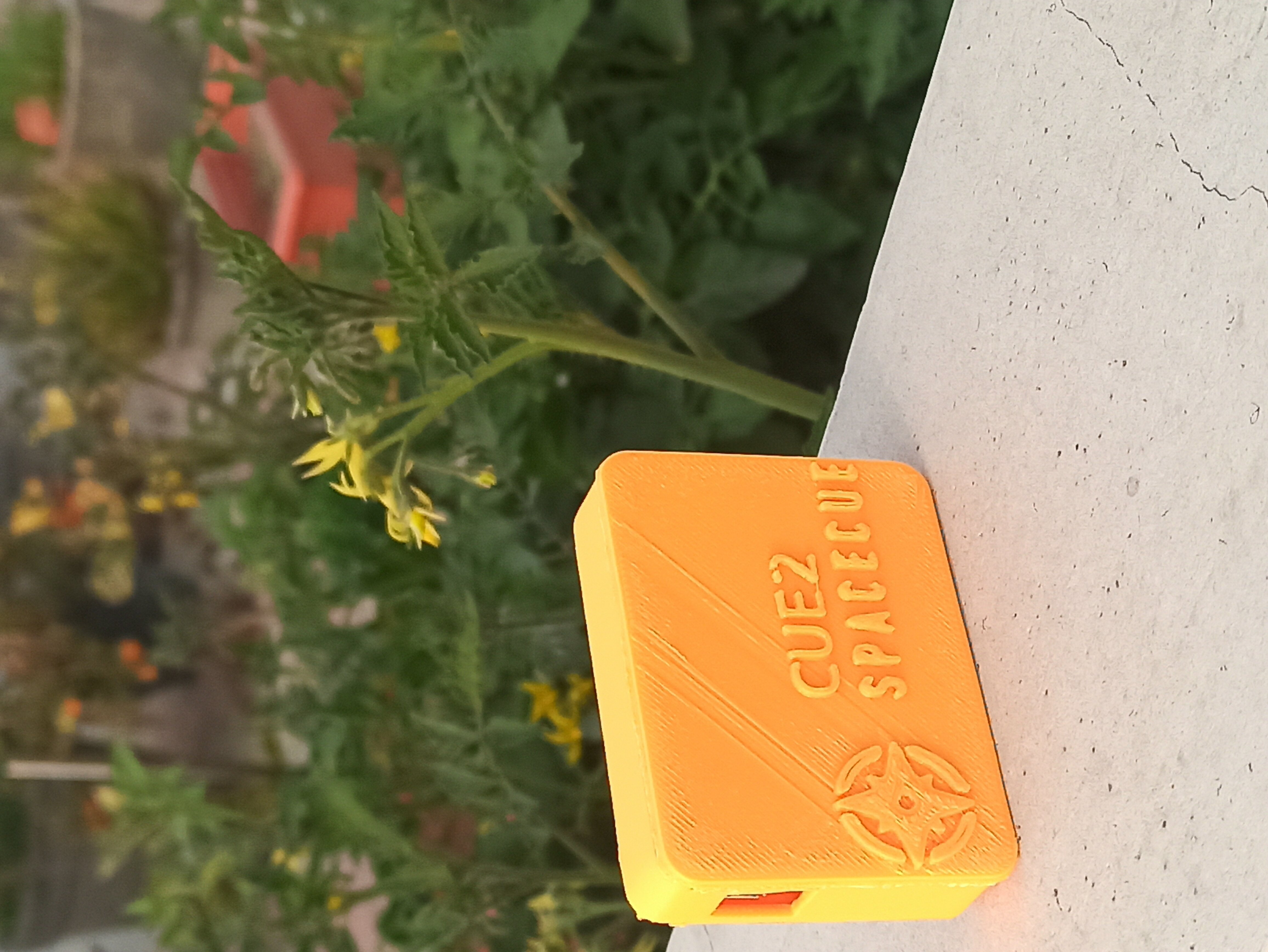
SpaceCue CUE2 an indoor tracking device - A failed story
X,Y,Z tracking device which can work indoors, mainly for kids who live in large housing societies.
7/6/2020
Problem Statement
A little while ago one of my relatives was residing in a housing society described a problem to me. They have 2 kids and they go out to play everyday but there is no way to tell where are they it’s been 3hrs since they are out but no way to tell if they are safe, in a known friend’s house or in a playground. As a parent you want to ensure their safety and if they are in a known environment. These are the main concerns.
The problem statement was interesting to me and I had time to work on it so I got started.
My Solution
As we break down the problem statement, essentially we need 3 parameters:
Design a wearable device that can report user’s X, Y, and Z positions in a housing society environment.
Once X, Y & Z is known, it can be superimposed on a housing societies map and with a boundary conditions. As a condition is satisfied that boundary becomes the current known location which can then be sent on Parent’s Phone.
Extracting X & Y
A pedometer algorithm was designed to track the number of steps taken by the user. User needs to provide approximate leg length as an input.
These details are combined to obtain a total displacement traveled from A to B. This would be the straight line distance, to obtain the direction of travel, a magnetometer sensor was added.
Magnetometer sensor functions as a compass. Now we have direction and displacement which can be plotted on a 2D map. A map was created for a section of housing society that had walls, corridors, house positions, and staircase positions.
User needs to wear the device on the waist, the device should stay static on the body. As the user moves, the algorithm would track motion and direction and reports coordinates that are compared with already stored housing societies map coordinates on the device. Hence as the user moves, the device would report the location in society. Sample map with some named sectors:
Extracting Z
To obtain Z, a Barometer sensor was used. The stored Map has floor details and as the device moves higher in altitude the change in barometric pressure is compared and the floor number is assigned.
Communication
The extracted X, Y & Z needs to be communicated on an application. For testing purposes, the coordinates extracted by the device were sent to the server and stored in a file. The device had a 2G eSim to connect to the network. MQTT messaging protocol was used to relay messages to the server.
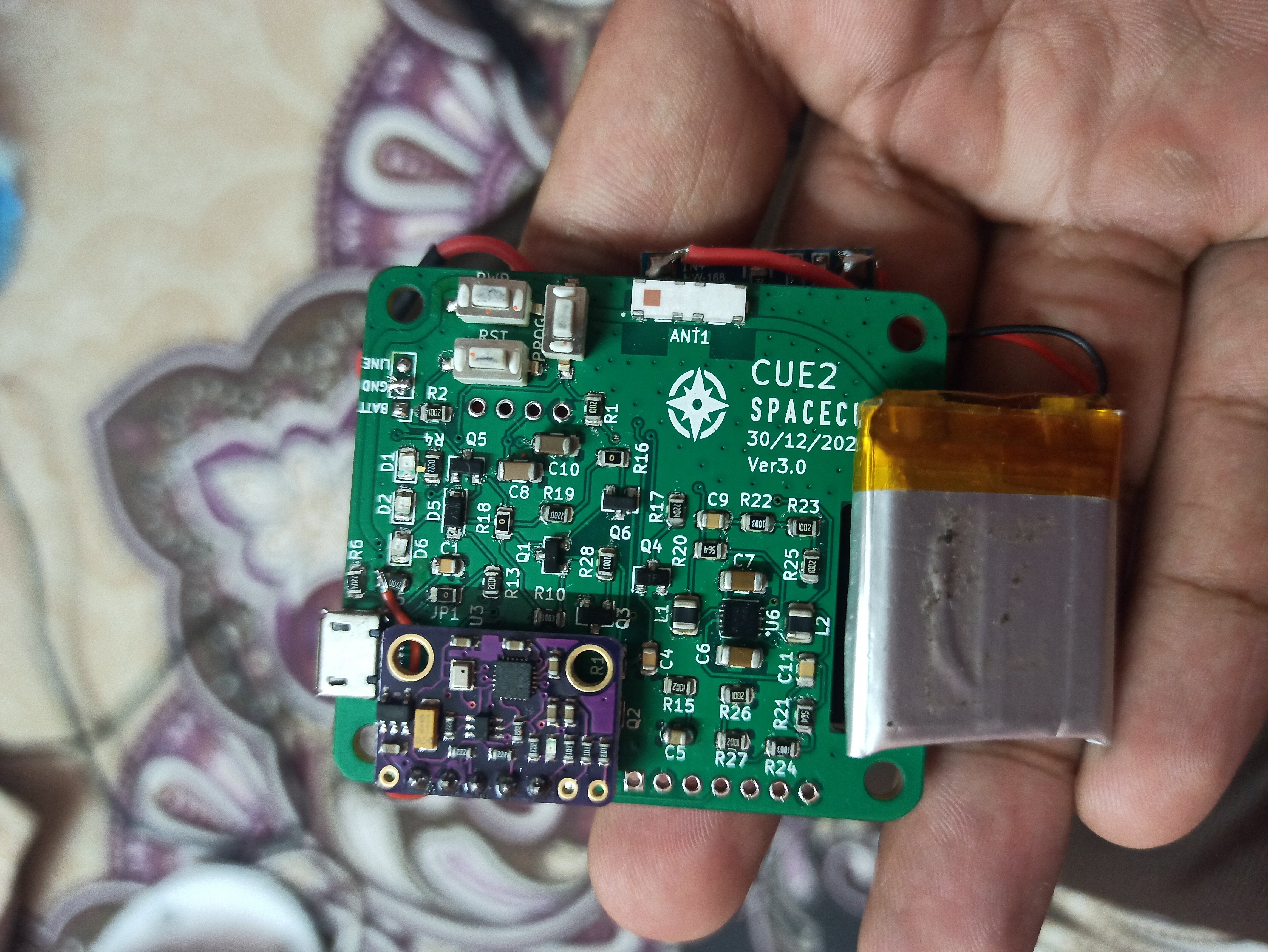
Sensors/Processors Used:
-
Cavli Wireless C32C1RM
Based ased on ESP32, has integrated eSIM. Device Supported NB - IOT protocol(not available in India yet) and has 2G fallback options. The device needs to be activated by Cavli for operation. There is a monthly charge for using the device network capability. Firmware runs on ESP32 and is written in C. Society Layout Map is stored in device EEPROM.
-
Pressure Sensor BMP280 To sense changes in atmospheric pressure and calculate floor number.
-
MPU-9250 Nine-Axis (Gyro + Accelerometer + Compass) MEMS MotionTracking™ Device: For Pedometer and direction algorithm.
Challenges Faced:
Connectivity
It’s hard to obtain a network signal in indoor environments. The device was failing to connect indoors. The user had to go outside, connect to the network, and come back again.
Compass Sensor
Compass sensor relies on measuring magnetic field. If any metallic object or environment comes near the device, the field will change hence reporting an incorrect direction. Also, the compass sensor needs repeated calibrations to be accurate. They work well when stationary but movement leads to new unknown magnetic fields causing a significant drift in the direction calculation.
Pedometer correction error
Pedometer relies on gyro + accelerometer data to identify if a valid step is made. All pedometers make errors. There will be small errors in step detection and final stride length calculation. If the device is used for longer, these errors accumulate and report an incorrect location. There needs to be a mechanism to location check and repeatedly correct this drift.
To correct this, I tried adding a GPS module, but the GPS module was not able to obtain a lock indoors as the sky is obstructed. GPS needs a clear sky to work. Also, GPS doesn’t have a good resolution for indoor location mapping.
Barometer sensor error
If the device is used for longer, any rapid changes in temperate, weather will cause changes in atm pressure and lead to incorrect floor readings.
Housing Societies Complexity
Various elements like Lifts, gardens, basements, parking areas different house types - 2,3bhk, and corridor shapes make map creation hard. Also if any changes are made in society, they have to be somehow loaded onto the device.
Device Wearability
The device needs to sit somewhere firm and attached to the body. It can’t be on the wrist as wrist movement is independent of the body. We need the device to be in a place where it sits stationary w.r.t body. This is not an ideal position and the user(kids!) are not willing to attach the device to a clothing and walk. There is also a chance for the device to fall somewhere or become loose leading to more errors.
These Challenges presented as significant blockers hence the project was abandoned.